
About Tarrant Rushton
Tarrant Rushton is situated in the Tarrant Valley about 3 miles south east of Blandford Forum. In 2013 the civil parish had an estimated population of 80. Starting in the north east the parish adjoins Moor Crichel, Witchampton, just touches Wimborne Minster to the east, then Shapwick, Tarrant Crawford,Tarrant Keynston and Tarrant Rawston. The ancient church of St Mary is built of flint and stone and parts of it date from Norman times.
At one time there was a hospital or charity in the parish dedicated to St Leonard. There has not been a post office in the parish but there was a parish school which in 1895 catered for 45 children. Abbey Crofts which in the 1890s had a population of 7 was transferred to Tarrant Crawford. The population in 1891 was 177. The 2073 acres are light loam and used to be mainly for cultivation of wheat.
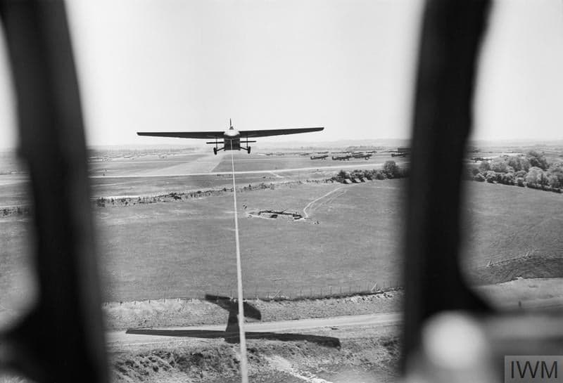
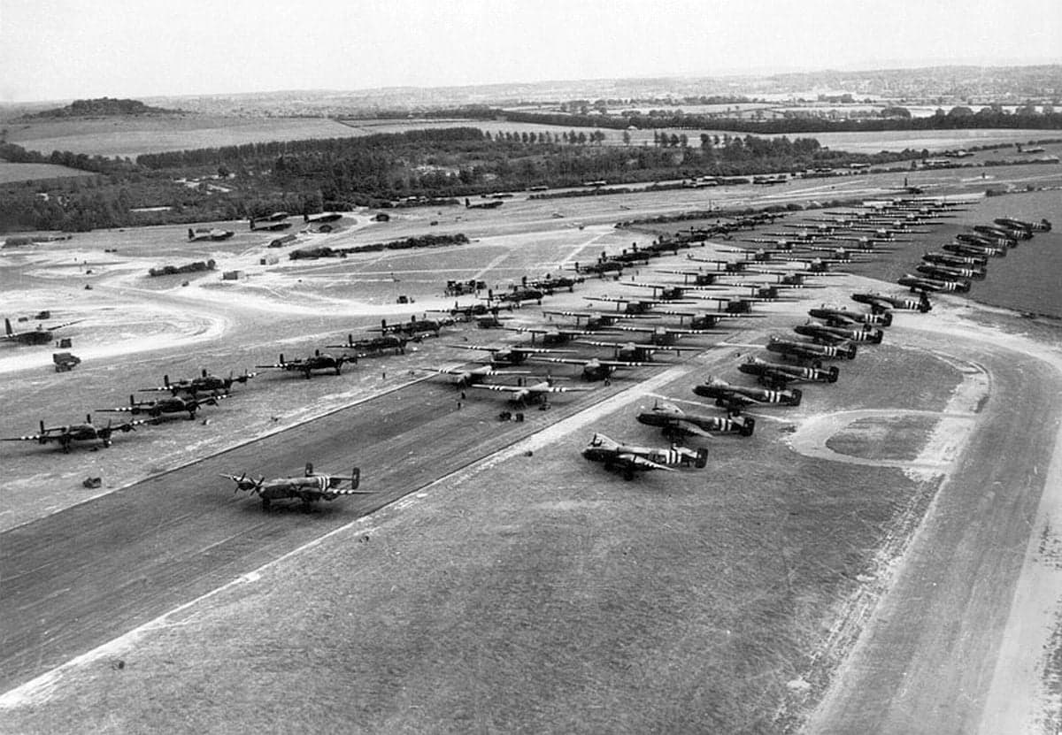
To the east of the village is Tarrant Rushton Airfield. It was built during World War II, during which it played a vital role in the D-Day invasion, being the location from which the Horsa gliders were drawn by Hurricanes to put troops on the ground and capture Pegasus bridge. It remained in use until the 1980s, first for Flight Refuelling and then as a gliding club . The development of in-flight refuelling for military aircraft was headed up by Sir Alan Cobham, whose family tomb is located in the graveyard at the church of St Mary. A road leads up to the airfield from the cottage and a public footpath follows the original boundaries of the airfield, where you can get good views on a clear day and some of the original black aircraft hangers are still standing, used now for agricultural machinery.
 |
 |

Full 5 Day Forecast
| Monday Jul 27 |
Tuesday Jul 28 |
Wednesday Jul 29 |
Thursday Jul 30 |
Friday Jul 31 |
|
|---|---|---|---|---|---|
| Conditions |  |
|
|
|
|
| Sunny | Sunny | Sunny | Sunny | Sunny | |
| High | 25°C/78°F | 28°C/83°F | 31°C/88°F | 26°C/78°F | 24°C/75°F |
| Low | 11°C/52°F | 14°C/58°F | 15°C/60°F | 14°C/57°F | 11°C/52°F |
| Wind | WNW 15 mph/23 kmh | WSW 11 mph/18 kmh | W 15 mph/24 kmh | W 15 mph/24 kmh | WNW 15 mph/25 kmh |
| Rain | 0mm | 0mm | 0mm | 0mm | 0mm |
